Print Maps

Print Map Print Map

Print Map Menu

  • You cannot print the OpenStreetMap base layers. Please choose a MapWise or aerial base layer instead.
  • Create an unlimited number and variety of maps.
  • Print maps for reports.
  • Print maps to take with you on the road.
  • A map with aerials may take 60+ seconds to generate.
  • Once the image is generated it may take 60+ seconds to load in the browser.
  • Map images are generated at an image size equivalent to 150 dpi. When printed, the map image resolution will be 150 dpi.
  • Remember to set the proper page orientation and page size in your printer settings.

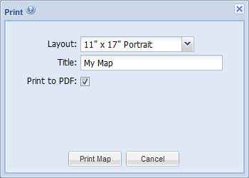
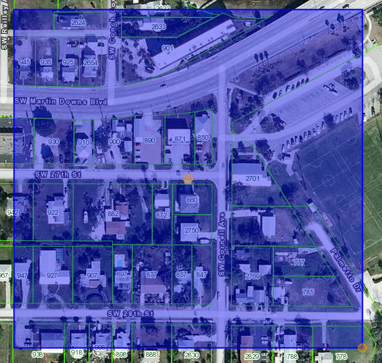
Adjust Printable Area
Print Map Area Select Box

  • After you select the print layout, an orange transparent box will appear on the map.
  • The box shows the map area that will be printed.
  • To adjust the print area, first click in the box and it will highlight blue.
  • To move the box, click-drag the orange circle in the middle of the box.
  • To resize the box, click-drag the orange circle on the lower right corner of the box.
  • The box conforms to the aspect ratio of the map layout you select.