Florida Parcel Search, Maps and Data
As a commercial broker, appraiser, or investor, your time is money—don't waste it navigating 67 different county websites. MapWise empowers you to streamline your entire workflow through a single, standardized interface. Instead of decoding inconsistent local data, you gain instant access to uniform property insights across the state, giving you the speed and precision required to stay ahead of the competition.
Conduct your due diligence faster with a tool built specifically for your demands. You get a seamless lookup experience for ownership, sales, and valuation data without the learning curve of multiple disparate systems. When you need to verify the source, simply use our deep-link feature to jump directly to the specific county appraiser page for any property, giving you the best of both worlds: centralized efficiency and official verification.
Use parcel information to:
- Find vacant land for development.
- Analyze recent real estate sales.
- Search property owner information.
- Generate property owner mailing lists targeting specific geographic areas.
- Perform due diligence on properties prior to acquisition.
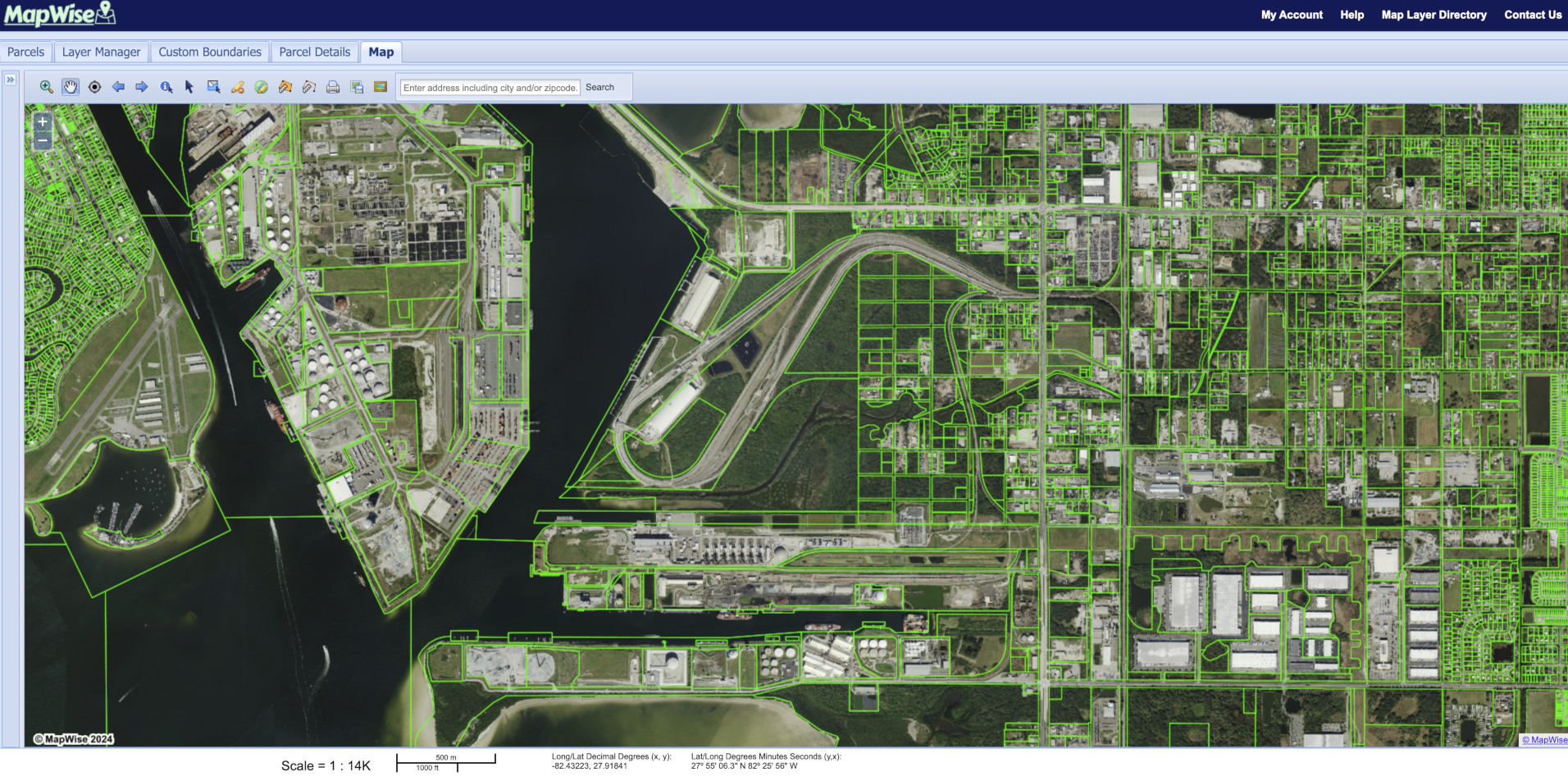
Save time researching property by using the same mapping and searching interface throughout Florida. Quickly zoom to an address using the address search bar above the map. Use the Parcel Search form to search for property by parcel ID, owner name, acres, sales and many other criteria. View different map layers with property boundaries overlaid including FEMA flood zone maps, wetlands, aerial photography, and elevation.
Trusted By

Master the Florida Market: The Unified Parcel Tool for Commercial Pros
Use the MapWise GIS Map Viewer to search property by a wide variety of criteria, show selected parcels on the map, print maps and more.
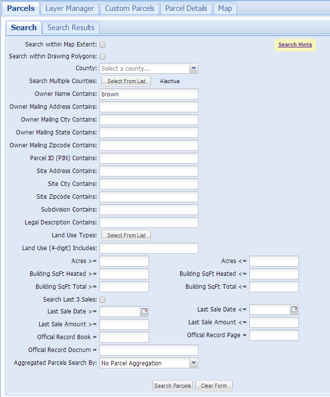
- Search by Parcel Identification Number (PIN), site address, owner name, sale date, sale price, legal description, and more.
- View property boundaries with aerial photos, flood zones, wetlands, elevation, streets, and more.
- Label parcels by PIN, altkey, owner name, and site address number.
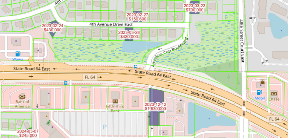
- View recent sales shaded by year and labeled on the map.
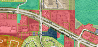
- View current land use shaded by parcel.
- Use "i-tool" to click on a parcel and view property record information.
- Use the Select Parcels tool to select parcels on the map by point, line or polygon.
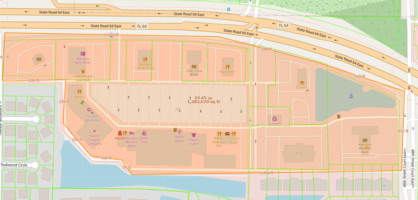
- Measure length and area on the map.
- Draw your own custom points, lines, polygons and labels on the map.
- Print PDF format maps at 11x8.5, 11x17 or 24x36 maps in portrait or landscape format.
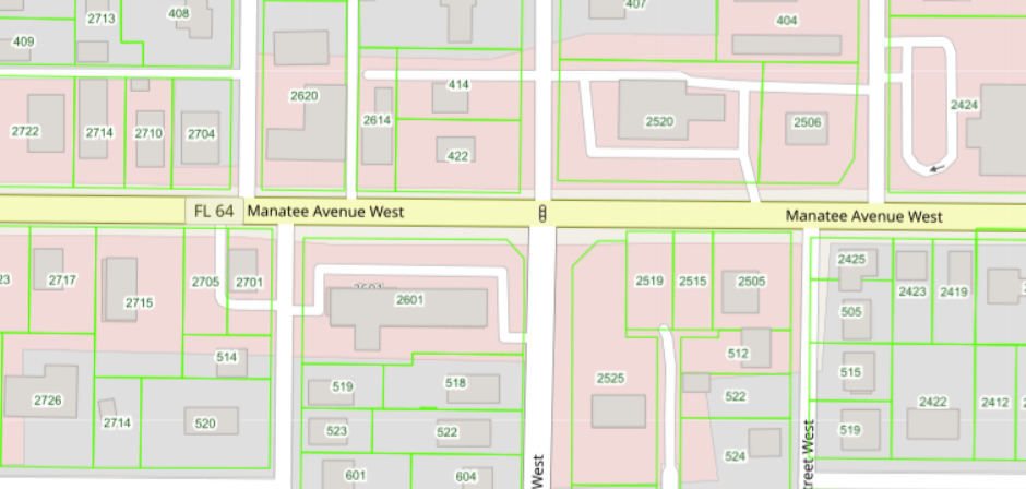
Current Land Use
Recent Sales by Year
Building Year Built
Site Address Labels
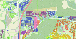
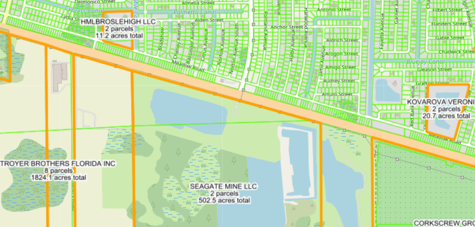
Parcels over 9 acres Grouped by Owner Name
Measure Length and Area of Parcels
Parcel Search
Search Results
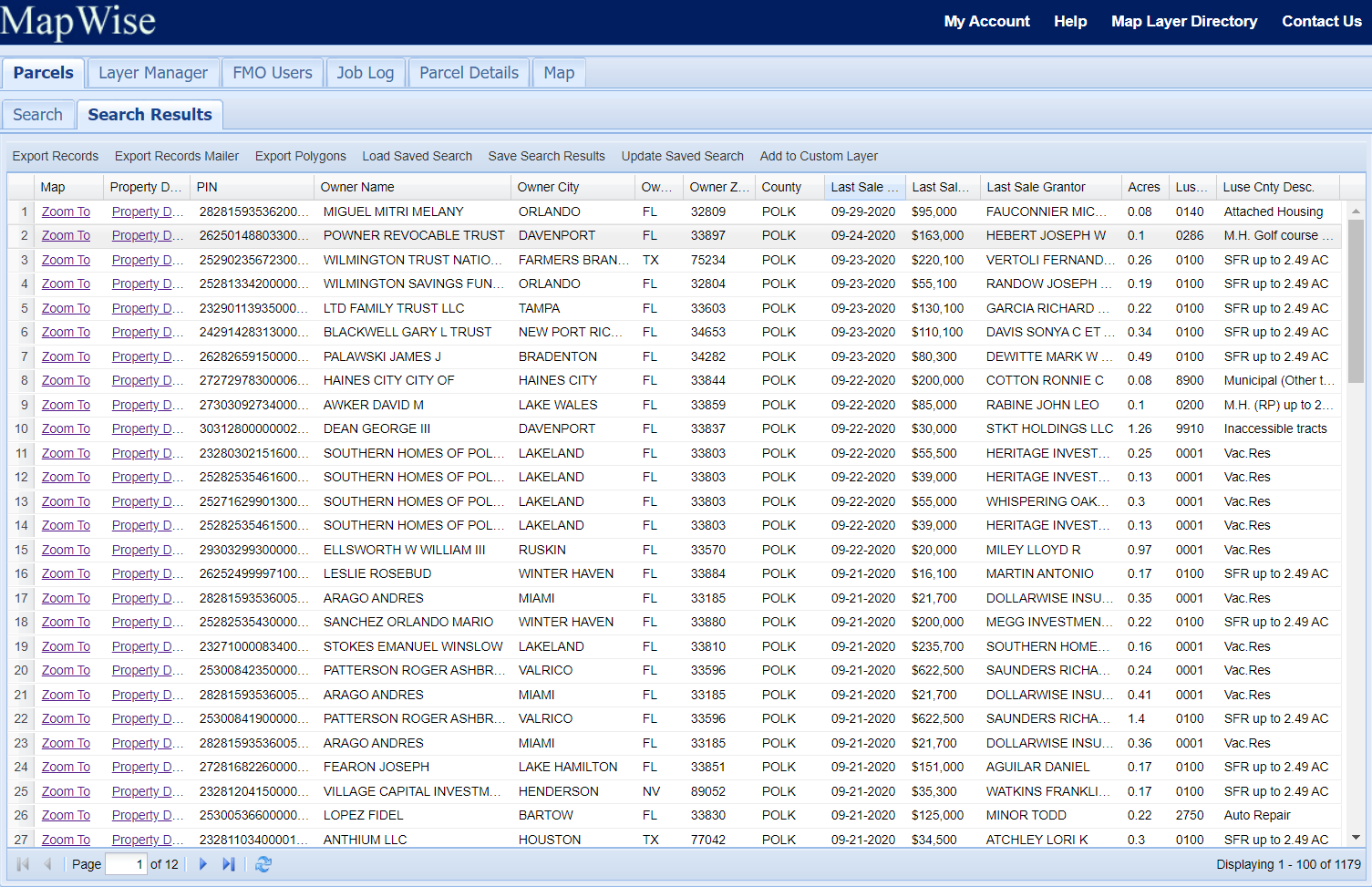
Export Parcel Records
Export up to 50,000 records from a property search to CSV, tab-delimited text, or Shapefile format. This is a ridiculously good deal.
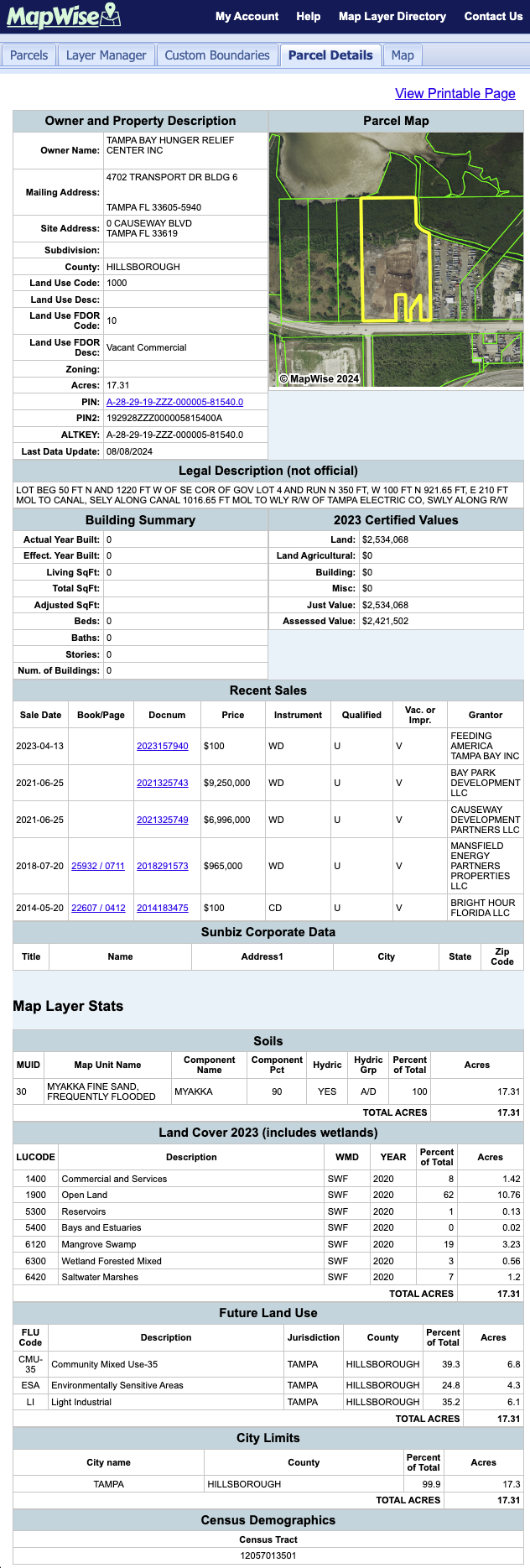
Property Information
Following is a snapshot of the Parcel Details page available for every parcel in the state of Florida. Most counties include a direct link to the county Property Appraiser web page for the property record and/or the official records page for each sale associated with the property.
GIS Parcel and Tax Roll Standardization
Parcel maps show the boundaries of real property. The term plat map is often used interchangeably. Each parcel has a large amount of information associated with it including owner name, mailing address, sales data, valuations, building info, and site address.
MapWise collects GIS parcel maps and associated tax roll data from all 67 county Property Appraisers in Florida and standardizes it to a common format. A single interface and common data formats and views speeds up property research.
If you are using GIS software on your desktop computer to work with parcel data, our standardized data saves you an enormous amount of time spent trying to figure out and process the various file formats provided by each property appraiser.
Data Update Frequency by County
The schedule for updating parcel data varies by county. The certified tax rolls are made available in Nov/Dec of the current year. Updates to the certified tax rolls include owner name, mailing address, sales, and for some counties valuations. Parcel lines are updated quarterly, semi-annually or annually, depending on the county.
Bi-Weekly Updates:
Alachua, Brevard, Broward, Charlotte, Escambia, Hillsborough, Leon, Manatee, Marion, Miami-Dade, Orange, Osceola, Palm Beach, Pasco, Pinellas, Polk, Sarasota and Volusia. Seminole, St Johns, St Lucie,
Monthly Updates:
Bay, Citrus, Clay, Collier, Columbia, Desoto, Duval, Flagler, Glades, Hardee, Hendry, Hernando, Highlands, Indian River, Lake, Lee, Levy, Martin, Monroe, Nassau, Okaloosa, Okeechobee, Santa Rosa, Sumter and Walton.
Bi-monthly Updates:
Baker, Bradford, Calhoun, Dixie, Franklin, Gadsden, Gilchrist, Gulf, Hamilton, Holmes, Jackson, Jefferson, Lafayette, Liberty, Madison, Putnam, Suwannee, Taylor, Union, Wakulla, and Washington.
Bulk Parcel Data by County
If you have your own GIS software and are interested in just parcel data, we provide standardized parcel data by county for use in your GIS software. Shapefiles include 100+ columns of information. All properties are included, including condos. Please contact us for more information.