The GIS Map Viewer Built For Real Estate Professionals
Search, analyze, and export parcel data across all 67 counties — with 80+ map layers, direct-source tax roll data, and tools built for how you actually work.
Trusted by 2,000+ Florida Real Estate Professionals

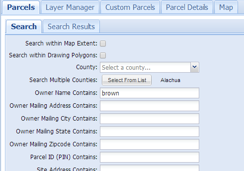
Find the Right Properties in Seconds
Filter by 30+ criteria including owner, acreage, sale date, zoning, land use, and more — or draw a polygon and search within it.
- Search within drawn polygons for targeted research
- Statewide owner & mailing address search
- Save and reuse searches across sessions
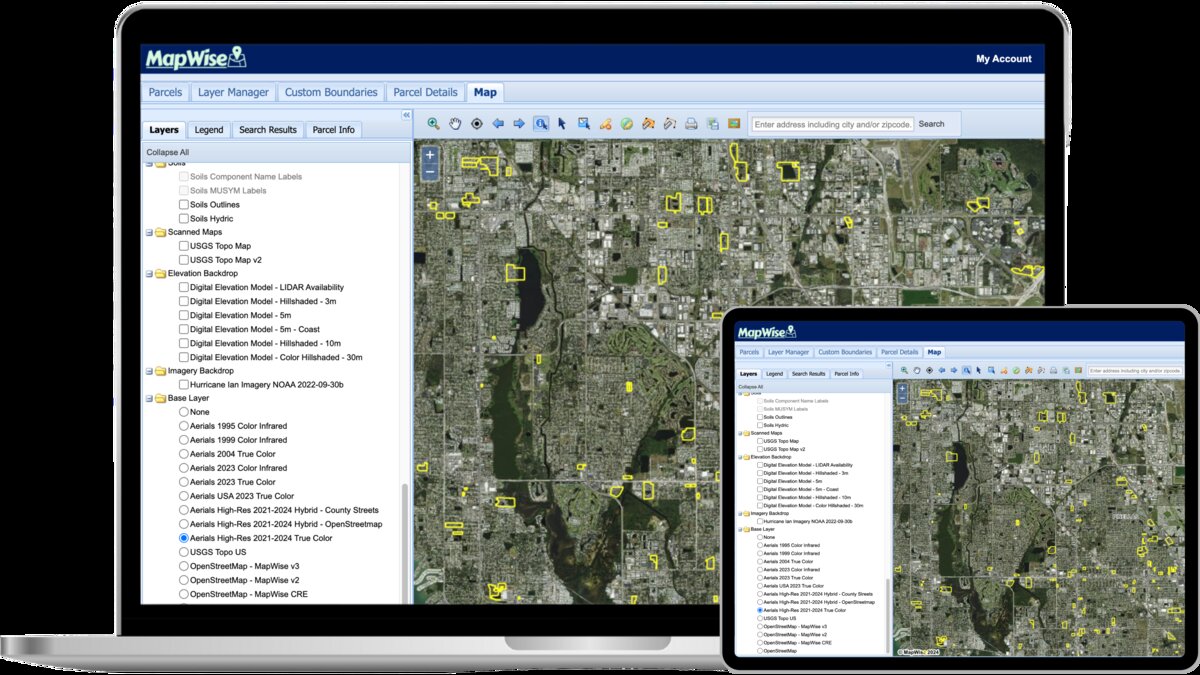
See Everything That Matters — In One View
80+ data layers integrate directly with parcel boundaries so you can overlay flood zones, soils, wetlands, and more without switching tools.
Start Your Research in Minutes, Not Hours
7-day free trial — no credit card required.
Data You Can Actually Trust
We source directly from county property appraisers — not third-party aggregators. Most alternatives rely on third-party data that’s 6+ months behind. When ownership changes, zoning updates, or a sale closes, you’ll know first.
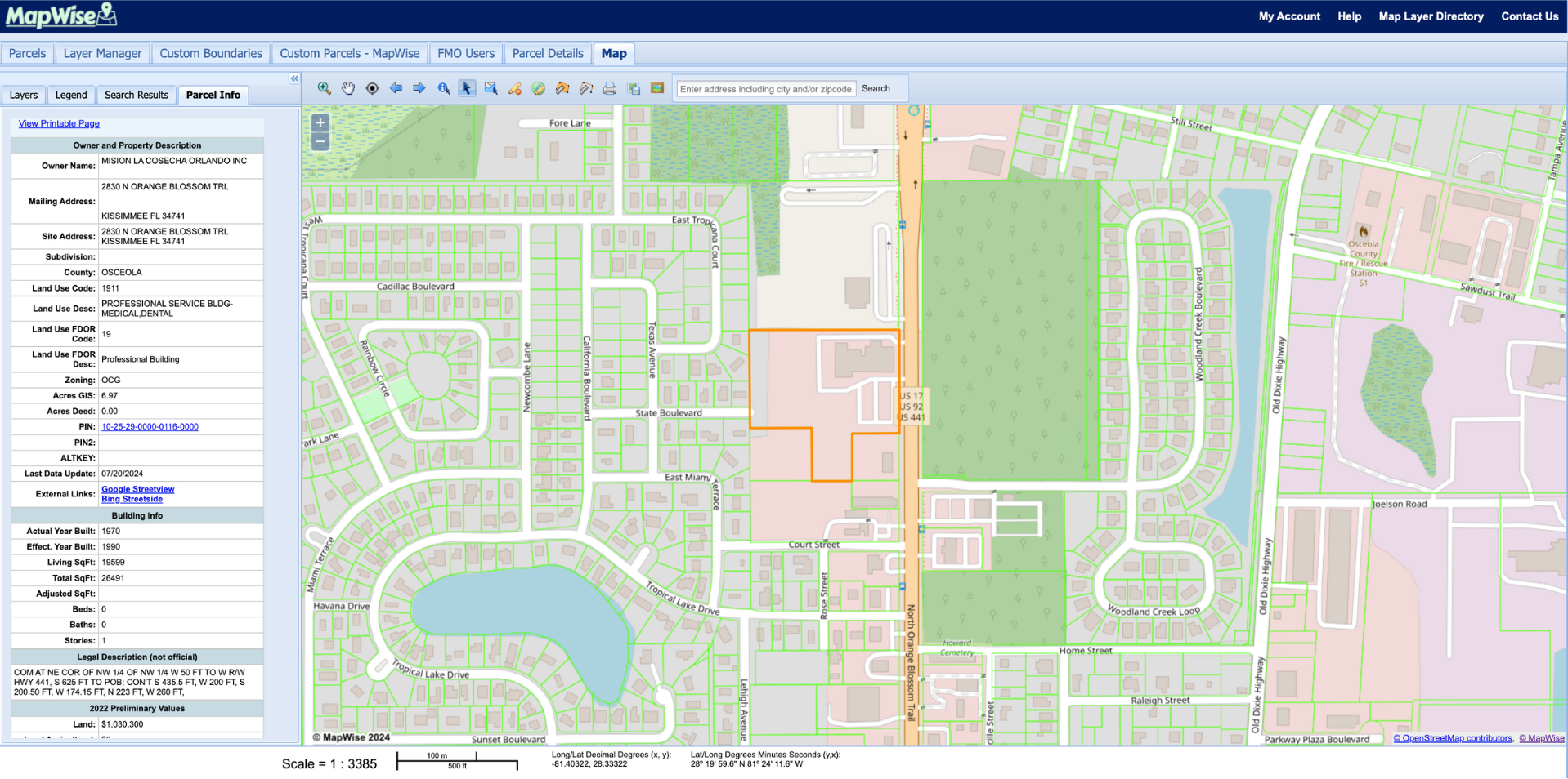
See Who Owns What — and Export It All
Grouped ownership shows you every parcel an owner holds — countywide and contiguous. Search statewide by mailing address to find LLCs, or aggregate sales by book and page.
Export up to 50,000 records with Sunbiz officer matching — competitors cap at 5,000.
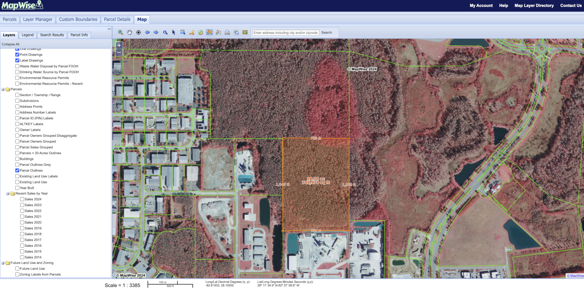
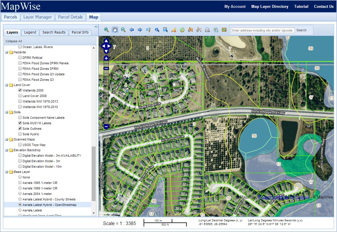
Measure, Draw, and Print Professional Maps
Overlay wetlands and measure acreage. Select parcels and convert them to drawing polygons instantly. Buffer highways or coastlines for setback analysis.
Print PDF maps from 8.5×11 to 24×36, or export high-resolution images for reports and presentations.
Other Platforms Are Already 6 Months Behind
Most parcel platforms rely on third-party aggregators updated quarterly — or worse. MapWise sources directly from all 67 county property appraisers every 2 weeks. When ownership changes, you’ll know first.
Start My Free TrialMore Tools. One Subscription.

MapWise Explorer
Search parcels on the go with our mobile-friendly companion app. Save favorites and share property info instantly.
Try Explorer
Flood Zone Tool
Instant FEMA flood zone reports with base flood elevation data and PDF export for all 67 Florida counties.
Check Flood ZonesFlorida Parcels API
Build with our data. The same direct-source parcel data with spatial search, full geometry, and monthly updates.
API DocsTrusted By Real Estate Professionals for Over 20 Years
Founded by a GIS professional with 35 years in Florida mapping. Since 2003, leading organizations have depended on MapWise for accurate data and easy-to-use research tools.
“The time we save would probably cover the subscription in just one week. We are so glad MapWise exists.”
Terry Smith
AVA Engineers, Inc.
“The Indispensable Tool for anyone professionally involved in the real estate business.”
Deborah Plaia
Managing Member, CHER FL, L.L.C.