Map Identify Features
Identify Feature ("i tool")
- Some map layers can be queried by clicking on the map to get information at that location.
- A popup window will show with information from any queryable layer that is turned on.
- Queryable layers include: Parcels, Future Land Use, Zoning, City Limits, FEMA Flood Zones, Land Cover, and Soils.
Identify Feature Popup
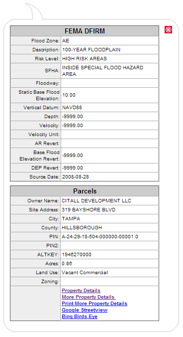
- When you select the "i tool" and click on the map, a popup appears.
- Click on a parcel and see owner name, parcel ID, street address, land use type, acres, and more.
- The popup results will vary depending on the map layers that are checked on in the Map Layers tab.
- The Property Details link shows additional info in the Parcel Info tab to the left of the map.