Select Features from Map
 Select Parcels on Map by Point, Line, or Polygon
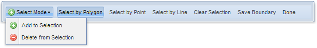
- Click on the map to define an area (polygon) to select parcels.
- A minimum of three click locations are needed to define and area.
- Double-click to end the line.
- The selected parcels will highlight on the map and the associated records will display in the Search Results menu.
- You can use the selected parcels to create a custom boundary.
- The custom boundary can be saved and becomes part of the Custom Boundaries map layer.
- Export selected records to excel by clicking Parcels->Search Results->Export Records