Zoning Labels from Parcels
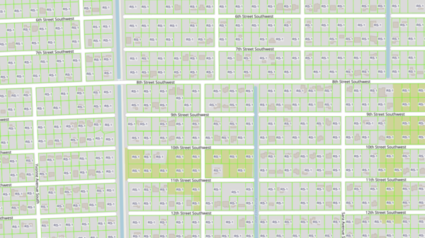
About the Zoning Labels from Parcels Layer
This layer labels each parcel with the zoning code recorded in the county property appraiser's parcel data. It is not the official zoning map. Appraisers keep a zoning field in their parcel records for their own valuation work, and MapWise reads that field straight from the parcel roll it loads for each county.
Because the code comes from the appraiser rather than the planning department, it can differ from the official designation. Appraiser records lag rezonings, some offices record a district family instead of the exact district, and some leave the field blank. Treat a label here as a starting point, then confirm with the city or county before relying on it.
The layer earns its place where official zoning is missing. Many Florida cities and smaller counties do not publish their zoning districts as GIS data the public can download, so the appraiser's field is the only parcel-level zoning available in digital form there. Where MapWise carries the adopted districts, use the Zoning layer instead: it is built from the city and county zoning maps and includes the district description and the adopting jurisdiction.
Labels draw at parcel scale, 1:14,000 and closer, and update with the parcel data.
Layer Details
- Visible Scale Range
- 1:423 to 1:14K
- Layer Group
- Zoning
About the Data
- Data Source
- County Property Appraisers (parcel records)
- Publisher
- MapWise Inc.
- Update Frequency
- With parcel data updates
If not, please contact us and we'll gladly help you further.
